I'm still map-making. Below is my world's map of central, modern-day Algeria, called "Gaetulia" in Roman and post-Roman times. Damned if I can find out what it was called in the 17th century - certainly not Algeria.
Specifically, I refer to the Sahara desert south of the Atlas Mountains:
 |
| A few details. Zanatan is a tribal association of Cameltaurs (camel- centaurs). Mozab is a kingdom of Goat-men, similar to bare-skinned gnolls. Tuwat is an empire ruled by the Djang, large and human-looking with four arms (anyone remember Dray Prescott?). Tamanrasset is a monastical republic consisting of qullan from the old Fiend Folio. The rest are human. |
As ever, green and brown hexes are arable lands (or oases), the brown higher in elevation. Pale yellow hexes are mixed grassland & desert. Pale red hexes indicates thin brushland & desert. Grey hexes are pure desert. Hexes are 20 miles in diameter. The above depicted is about the size of Texas & Oklahoma, +10%. Dotted borders are non-patrolled. "Arable" is defined by there being proof of human habitation at a latitude or longitude located within the 20-mile hex. The numbers on the side of the map will tell you how many hexes this is from the North Pole.
While yes, this is the Sahara, it's important to see it as a mix of differentiated expanses and areas - none of which have a great deal of detail to be learned on the 'net. Still, I thought I might piece together some of these, adding pictures as I go. What the hell.
The Mountains of Ksour, the Rached Mountains and the Mountains of Zab are all part of the 'Sahara Atlas' - and these aren't even the names we'll find if we look. Most of my sources are in French, because Algeria was controlled by France for most of its modern period - thank you Google translate.
Monts des Ksour. I'm going to use French links through most of this post because they have more information than their English counterparts. The Ksour chain has a rugged topography made of long ranges running southwest to northeast. Rainfall is 300 mm a year. There are rock stations, known for prehistoric art. On the map above, the grey area marked as mountains is really the southern side; the grass & desert hexes would be the north slope. I hunted around looking for a south-side pic; I'm only guessing that this is it due to comparing the vegetation with places I recognize on the north side:
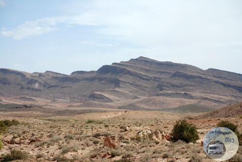 |
| Near Fuguig in Morocco. |
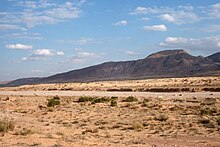
Djebel Amour. 'Rachad,' shown on the map, is the older name for these mountains. The Sahara Atlas changes here, becoming tabular, lower and filled with deep valleys. Rainfall is slightly higher, 300-500 mm a year. The mountains spawn wadis both to the north and south.
 |
| Near Beni Awf |
Monts du Zab. A mountain knot to the east of an important passage through the Atlas, a group of oases called the Zibans (the mountains seem to be called that too). I could find almost no hard information about them, beyond the fact that they exist. For example, I found a gazatteer that said the following: "Entre Ain Rich et Biskra." I have to love it when a writer is forthcoming like that. I expect they are a few dry, waterless lumps of stone.
 |
| This site confirms Wikipedia; this is the Monts du Zab. |
Le Grand Erg Oriental, that I'm calling the Great East Erg, is a massive expanse of dunes and sand following a network of underground river beds (where sometimes water can be found). It's generally believed that this was once a fertile plain. Today it is the great sand heap that you usually see in movies, as it's northern edge is near Tunisia (Tataouine, the literal name of the town in Tunisia where the Star Wars movie was filmed). There are lots and lots of pictures for this area. I've picked just one below:
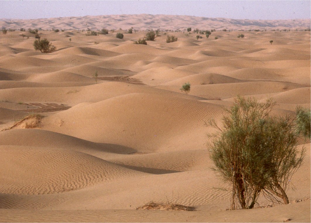 |
| An area of the erg in southern Tunisia. |
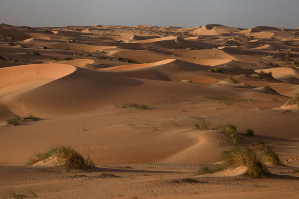
Le Grand Erg Occidental, that I'm calling the Great West Erg, is even more insurmountable with sand dunes than is the east. The wikipedia link calls it (trans.) "oases scattered in the sand waves," which is lovely. Here it writes that the (trans.) "The vastness, the unknown, is strange and magical." A glance at collected pictures gives is a slightly different character than the Oriental Erg. For one thing, the dunes in the west seem huge, more yellow and less dusty brown.
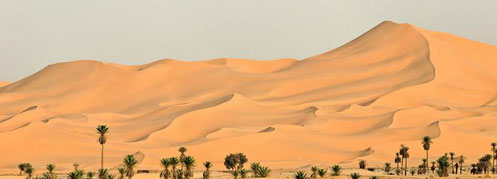 |
| Near Saoura |
Plateau of Tademait. Things get more obscure as we move south past the Grand Ergs. (I've mistakenly called this 'Tademalt' on the map; course, it's my world, I can call it what I want). For this, the English wikipedia is better: it calls it a "rocky plateau made of cretaceous terrain." It adds that this is one of the places where the heat of the Sahara is most extreme. It is virtually rainless.
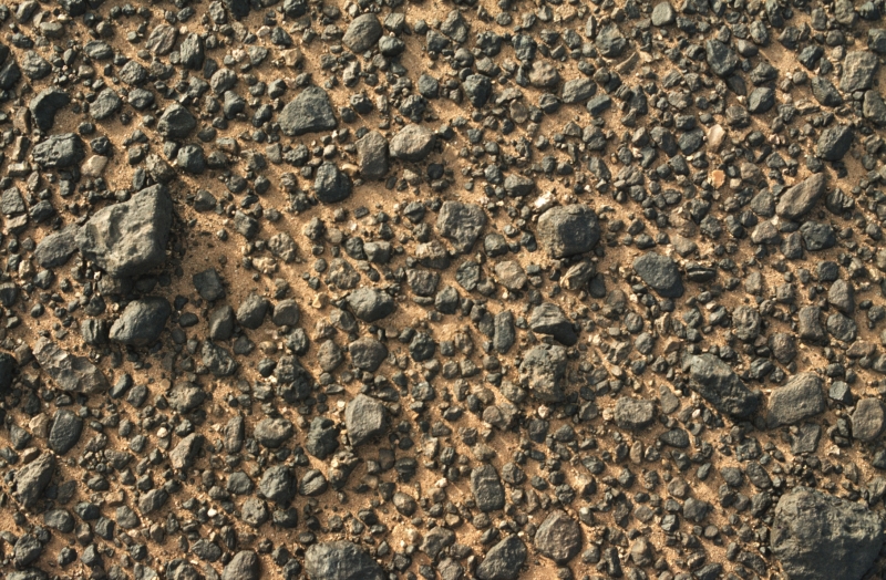 |
| I had to include this pic of Tademait's ground surface. |
 |
| This is Tony waking at dawn at the edge of the Tademait Plateau |
Touat, Tuat or Tuwat (even Twat, if you're aching to go); a hot desert on the edge of the Tademait plateau, marked by a string of oases on its western edge, making the area practical for travel. These oases have been used - probably - since the time of the ancient Egyptians, going back to the when the pyramids were built. Summer temperatures in the Tuwat are consistently 46 C, making it one of the hottest areas in the Sahara. The actual area of desert is quite small, before it becomes a differently featured area:
 |
| Dunes near Adrar, the most important oasis |
Tidikelt is a comparatively green area (the name means 'palm') that is below sea level in elevation - thus it is at the 'bottom' of the Algerian water table. Temperatures compare with the Tuwat. On the map, it shows 'Tidikelt Depression' only in the lower corner, but in fact the region extends into the various arable green hexes shown. Sala (in the non-D&D world, Ain Salah) is a major by-way between north and south of the Sahara.
 |
| Called 'The Lion of Tidikelt,' near Ain Salah. |
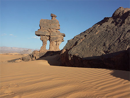
Asedjrad Plateau. There was very little information about this. On my map it is just a small name describing a fairly small area. Most total detail I could find was "it's a plateau." That's when you know the place is a long way from everywhere. For example, this page tells me it's 9 hours drive from the nearest decent city. The landscape is barren, hyper-arid and 44 C in July (so, slightly higher, slightly cooler than the Tidikelt. The south edge is marked by the Tinkadiouene, a mesa rising 300 meters above the desert. Best shot I could get:
 |
| Tinkadiouene |
Ahenet (no link), including the area of Adrar Ahnet, is an area of stone desert marked with wonderful bluffs, mountainous features and stone blocks. See here for a 17-minute film of some interesting places where the terrain gets interesting. Much of what is featured is the eastern edge, near the region of Adrar (not to be confused with the oasis in Tuwat Desert, mentioned above, 500 miles away). The film gives a good sense of the uninteresting desert also - rocky, unpleasant, flat.
 |
| But not without camels. |
Ifetese & Agerar (no links). This is a mystery. My map clearly lists the Ifetese hills, marks them at +1500 meters, 500 meters or more above the plain - and the Agerar as being a desert between the Ifetese and the huge Ahaggar (Hoggar) mountain range.
However, the internet turns up NO results. At all. My Key-Porter Atlas is 1997, but things change. I can find a reference for a nearby city, Arak, to the Arak Gorges; and Adrar, described above, is directly south of Ifetese. So what I think is that the "Adrar" has come to include Ifetese and that the Agerar on my map is in fact the "Arak Gorges." That's how I'm reading it, anyway. I only mention all this so that the reader can see me showing my work.
Here's an image from the Arak Gorges:
 |
| An area described as having wood, water and grazing |
Tassili n-Ajjer, or 'The Plateau of the Rivers,' a name I could not resist using on the map. A massif and high arid plateau of sandstone, where rocks are turned to sand by frost wedging. I am certain that this range and the Ahaggar are responsible for the presence of water in the gorges above (what I'm calling the Agerar 'rift.'
 |
| One picture isn't going to be enough for this place. |
 |
| Fantastic |
 |
| See more for Tassili n-Ajjer here. |
Ahaggar, or Hoggar, mountains. A giagantic mountain knot about the size of Portugal (the wikipedia entry seems to be missing a zero), with quiet volcanoes, cliffs of basalt and porphyry, comparatively cool weather and terrain to challenge the pictures above. It is a favorite destination for mountain climbers. In height, it hits 2,918 meters - so slightly higher (and craggier) than the Davis Mountains in West Texas and not quite as high as the Pyrenees in Spain. The Ahaggar look NOTHING like either, however:
 |
| A very, very different sort of place. |
I'm nearly done. The Erg of Reh and the Inharharene Plateau are sandy extensions of the Great East Erg (without as many dunes). I couldn't find entries for them, either. Al Hamra and the Awbari Desert on the east edge of the map are both large areas extending into the Libyan Fezzan. The Tiniri Sand Plain, at the very bottom of the map (on the right) is a sand flat that covers half the country of Niger, an area bigger than California.
I think by now, however, I've made my point. I've been searching for pics and explanations now for four hours. It is time to post this beast. I'm sure I made my French readers happy by linking a lot of French language pages.
(This is a repost because I don't think my original went thru - Blogspot sometimes dislikes that I have 2 Google accounts. Delete if it did.)
ReplyDeleteWhat's the difference between the light gray hexes and the dark gray ones? With "light" being ones the color of the hexes under "Great East Erg" and "dark" being the ones under Mountains of Ksour.
It seems like "dark" might mean mountains - is that right?
Call the darker hexes 'differentiated highlands' - that's close to the truth. Note that I'm considering the mountains of Adrar Ahnet to be Ifetese.
ReplyDelete