Showing posts with label Hex Generation. Show all posts

Friday, April 14, 2017

Notes on Stavanger's Economy

A very long time ago, I wrote a series of posts that I called "never too much economics."  I have to apologize to start: if you have not followed past posts I have written on hex generation, economics and my trade system, I'm going to lose your attention very quickly.  There's nothing I can do about that.  I have been working on this method for logically calculating the structure underlying any part of my world, very large world that it is.  The work shown today represents just a few hours of work for this particular region in my game, that created for the Juvenis campaign.

I'm going to use some of the details of that post in order to address this map:


This is a part of my larger game world expanded from 20-mile hexes to 6.67-mile hexes (6-mile for short), using a hex generator I've talked about on my blog before ~ though not for a long time.

The map shows production for food, hammers and coin, similar to the same measurements for the old game, Civilization IV.  Five years ago, I defined one food as sufficient to feed 167 persons at a minimal rate of sustenance, a very unpleasant 1,700 calories per day.  We may assume that is for any period, as we're not actually measuring the weight of food, only its consumption vs. its production.

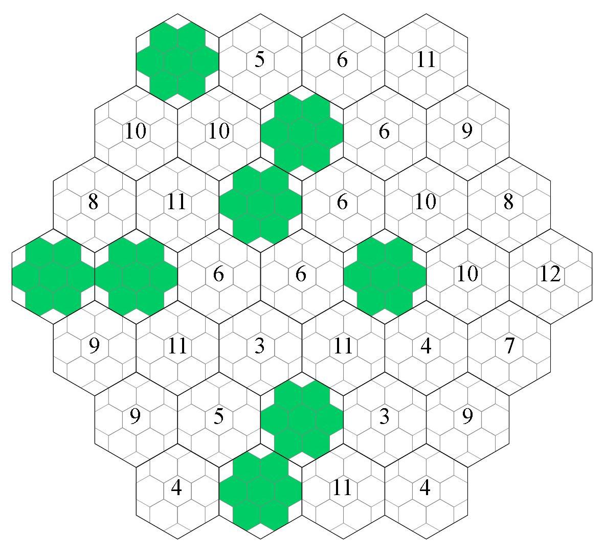
Back in the day, I also wrote that a hex with two food symbols showing should be read as the binary number "11" ~ which would be 3 in the base-ten system.  A hex with three food symbols showing would equal the binary "111," or 7 in the base-ten system.  Thus, three food showing will feed not 500 persons, but 1,167.  The greatest production on the map above is the hex surrounding Stavanger, showing a loaf and two slices, or "1111111," or 127 in base-ten, enough to feed 21,167 persons.  That's not bad, but the county of Rogaland, depicted above, has a population of 25,627.

How much food is showing, in base-ten numbers?  I may have miscounted, but I get 392 food altogether, enough to feed 65,335 people.  That is, at sustenance level.  That 1,700 calories is fairly low, so we can double that amount for the people around Stavanger and still have enough food for export.  This makes sense.  Norway is a relatively rich country, with productive forests, plenty of water, excellent soil (where there is soil) and a relatively low population.  It ought to be an exporting region ~ even if it is only enough to feed 7,040 persons at a comfortable 3,400 calories a day.  There are many more people than that in the world.

The coins showing work the same way as food.  The number of coins in a given hex show an exponential progression, so that the hex with Stavanger in it would have 63 coins (binary 111111). Altogether, the region shown has 115 coins - so Stavanger by itself represents more than half the total wealth of the region.  This, too, makes sense.

My post on coins argued for a fixed rate of 2,500 g.p. per coin showing, with the understanding the the principle of money is that it flows through the hands of people on a continuous basis.  In effect, I argued, this would mean that the total income for all the persons in the region would be three times the actual physical wealth ~ arguing for a low velocity that would correspond to a 17th century world.

I'd like to deviate from that old number, however, as it was based on an ill-proposed Player's Handbook reference.  I should be able to do better.  For this, I'll turn to my trade tables, specifically the list of goods and services that are produced in Rogaland.

As it happens, Rogaland has a very poor collection of references for my trade tables:


That is a very sad collection of things. Clearly, the encyclopedia I drew from did not have much of a description for Stavanger ~ but the trick is not to rush forward and change it, because that seems best, but to presume that the region is economically depressed, regardless of how much food it produces or the number of people.

At present, my overall trade numbers (subject to change as I add more regions) indicate that one reference is worth 941.18 gold ounces, or 7,647 gold pieces per reference.  Since the total value for Rogaland is only four times that, or 30,588 g.p., it is plain that the number per coin shown on the map is going to be less than 2,500.  30,588 divided by 115 equal 265 g.p. per coin.

With a per capita income of only 1.19 g.p. per person, we have to wonder how anyone can afford to buy books and statues from the party for 1,750 g.p., as recently happened in the campaign.  I admit, that is a problem; but I paid out that money before making the above calculations.

We can push the velocity of the money in the region by 1, to a total of 4, then presume that the total income of the region passes specifically through the hands of the merchants (along with the upper class, the nobility and the hoi polloi, as detailed in my original post).  If the merchants represent 0.1% of the total population, this makes the average yearly income for a merchant in Stavanger (they would all be in the trade town) a total of 1,190 g.p. per year.

We can also assume an accumulation of wealth, arguing that gold (and everything else that doesn't spoil) is steadily mined and added to the system, where it spreads outwards in the form of trade and ultimately collects in the hordes and savings of people.  We might argue that if 2% of the total coins in the world is irrevocably lost to monsters, lost hiding places and being sunk in the sea every year, then there is something like 51 years worth of accumulated gold pieces in the world (at that point, loss more or less equals production).  That is more than enough for an apothecary to dig into their accumulated 56,000 g.p. of wealth to buy something very special.

This could mean that the monetary assets for Rogaland are considerable, even if much less than other regions with far more references to goods, services and manufacturing.  Like any good economist, it depends on how we propose to juggle the numbers.

I think I would want to create additional regions, then spread the income over several regions and not just use Rogaland as an isolated measurement.  I'd argue that the loss of coin from the system was higher, just to reduce the pure wealth available.  I think a combination of factors could lead to a better approximation.

What we want, of course, is to be able to identify the wealth produced by a specific hex, giving us a number as to how much coin is a) regularly flowing out of that hex, if the player wishes to start a venture of some sort, and b) how much gold is buried in the hex, in terms of plundering it from monsters and/or dungeons.

This lets the gold of the hex determine how much product is sold in Stavanger, if the party decides to go fishing or lumberjacking, rather than trying to figure out specific production figures for every imaginable sort of product.  The player spends x time in this forest, which produces y amount of money per year for z number of people (determined by food supply).  This makes a very simple calculation for how much money the player can make from time spent, without the fuss of guessing how much fruit or flax or feldspar a given hex can produce.

Finally, I come to hammers.

I am at a loss here.  My old thinking has one primary problem: the system does not generate what sort of buildings have already been created, or what has been done with the hammers generally in the last 750+ years of Stavanger's existence (founded 862).  If we are only talking of the hammers being used for civic improvement, then they are only available to those who actually control the hex.  If so, I can safely ignore them for the time being.

I would like another value attached to the hammers, however ~ a problem I haven't considered for a very long time and thus also a problem I have distance on.  Since I've only rediscovered the problem in the last couple of days, I haven't even begun to solve it.

What I'd like is some meaning that is applicable to player characters at any point.  It could represent the amount of labor in the area, available or otherwise.  It might somehow represent the present existing infrastructure, but I'm not sure how.  It is easy to add it all together to get the size of Rogaland's military, the work force directly under control of the upper classes or even the amount of original created artwork that can be found (related to the bard).  I just need to think about it.


Wednesday, June 4, 2014

What Is He On About?

As I near the end, I find myself thinking about what I'll be able to do once I get done with the big book - namely, running again.

I have some unfinished projects that are in a sorry state.  The idea for sage tables came at an unfortunate time, there are spells to rework, the wiki to update and so on.  But the project I find myself thinking about today is the Hex Groups Chooser.  I'm going to need that in somewhat better shape so that I can generate the area where the online party has landed, on the coast of modern Eastern Ukraine.

I haven't written about this for awhile, so I know that there are some who have no idea what I'm talking about.  If you're interested, I suggest you read some of the following links:  these posts on hex generation and hex generation 2.0; these posts on 'never too much economics'; and this terrifying video; that should keep the reader busy for several days at least.  Meanwhile, I'll get on with my thinking.

My problem with the Chooser above came as I moved from less inhabited 'groups' to those that were more civilized.  While trying to devise a system that would, simultaneously, determine what was in the hex, the food production of the hex and the potential manufacturing power of the hex, at the same time as working out the effects of those things on happiness or health, I think I went a bridge too far.  It got increasingly hard to keep it all in my head, as well as in a workable spreadsheet, as I got into the 5th group, and as a result I stopped working on the system altogether.  Basically, to get some distance on it.

I think what I needed to do was work on it one conception at a time.  First and foremost, I need to figure out what is in the hex, regardless of the effects of that thing upon other things.  It is tempting to suppose that if you have evidence that there's a type of food, it is easy to determine how many people that food will support, and then in what sort of collective those people live, thus determining communications with other collectives, protection, heirarchy and so on, but in fact these things begin to stack up until there's too many what if's to account for.  I believe that by generating the existence of things based only on the infrastructure to begin with, leaving the effects of those creations for later, I should be able to get a macrovision for what's going on once I have generated, say, a full province.

So, I'll be simplifying the Chooser in the first incarnation, so that I can generate all the things that exist, right up to the most sophisticated of civilization - universities, hospitals, palaces and the like.  I doubt if anyone will mind; I doubt that anyone has tried to use that Chooser on the wiki.  Heck, I wonder how many people even understand right now what I'm talking about.

Sometimes, I feel like I am this person in a vast, empty landscape.  I can see the rest of humanity as a tiny little point in the distance, and for reasons I can't explain I find that very encouraging.  Of course, it might mean that I'm nuts.

As I've said before, I have to appreciate the world building systemics that went into Civ IV.  I still haven't seen Civ 5.  I'm not even sure I want to.  For the most part I've stopped playing the game - that aspect holds little interest for me now.  I simply like the health-happiness-food-hammers-coin framework in which to build upon, partly because it manages to work so well into my own reference-product-trade-hex founded world.

These are just a few thoughts.  I'm too scattered now to really get gritty and start working out details - if I did, that would pitch most of the day and I've really got to keep my eye focused on the priority project.  But I felt encouraged to write something, just for my own sake, to keep my head in the game a bit.

Friday, April 12, 2013

The Next Logical Step?

Just a quick post today, to sort of blurph out a few things so that they're in the atmosphere before I settle down to piecing them together later.

This, then is the logical next step:


This is Zante from the previous post, which was the largest city on the island, broken down into its "sub-groups" ... so that the 2 mile hex (really, 2.22 miles) can be accounted for in 434 yard hexes - the size of the small hexes shown above.  The question is, how does one define these "micro-hexes" ... when the infrastucture numbers that were there before have now ceased to mean anything.  This was (by the last accounting, and the page on my wiki) a Type II hex ... but that's not actually useful.

The population of Zante is 9,193.  It was founded approximately 1,600 BCE (which makes it old even for a Greek city).  The center of the city is actually 554 feet above sea level ... so that does tell us the streets are fairly steep, since the blue above IS sea.  I can also add that the city makes raisins, olive oil and that it collects and slaughters goats on the island for transport.  It also transports a lot of the other grown things on the island, oranges, lemons, cranberries, melons, wheat, honey, olives and grapes.  And of course the flint from the mine on the north end of the island.

None of this is especially helpful in guessing which of the black areas on the above map are occupied by shopkeepers, guild artisans, elite residences, slums, corrals, greenspace, shops, the market or the red light districts (with their taverns, inns and horizontal refreshments).  Nor does it tell me how much of the city is occupied by each.

Moving on with what I can measure.  Each of the small hexes above is 163,121 square feet, which equals 3..745 acres.  The area which I have (with no logic at all, just wanting to make it smaller than the hex in the last map of Zakynthos I drew) works out to about 28 hexes, or about 105 acres.  This adds up to 87.7 people per acre ... which, happily, works out to a reasonable number according to this document here.  Happy day.

That's also about 328 persons per hex.  If the average household is 7 (grandparents, parents, three children and one additional family member or servant), then that's 46 households per hex.  Interesting, but not exactly helpful.

I'm not sure if anything is.  Consider this city map below:

Glorious Lankhmar

All very stunning to look at, and really not at all to the least sort of logical scale (the building walls are dozens of feet thick, technically, even the minor buildings) ... but how is it USEFUL?  I mean, actually.  Is there that much that is gained by knowing the number of building fronts on Pimp Street between the Street of the Gods and Temple Street?  How often are you going to use that sort of information?

We generally use a large scale map to define how long it's going to take a party to travel between two distant points, so we can calculate the number of encounters, how much food they're going to eat and so on.  Are you really going to calculate how long it takes to walk from Carter Street to Ox Cart Road?  Do you care?  Or are you just going to say, "Hey you're there."  And even at that, does the destination need to be named something?  It's all nice window dressing for a Leiber book, makes you feel like you're somewhere, etc., but all the party wants to know is how much the leather armor costs.  They don't care if they bought it on Grain Street or Great Gate Road.  It's a suit of armor.  Maybe, if you cared, it might make a difference if it was bought on Cheap Street or Barter Street ... but seriously, isn't that a question of how it's bought and at what price?

And how flipping boring does it get when, as a player, you're having street names thrown at you in session after session, as a place you must get to.  I've done it.  It's cute ... but really, saying there's an address engraved in the key and "We go to the address" covers it pretty well, without there ever needing to be an actual street named.

So while I can go smaller ... and maybe work out something for what's where based on perhaps how high the group of hexes is above the city's lowest point (which seems like ti might separate the offal from the palace, as it were), someone will have to explain to me why its worth the bother.  For the present, I'm not crystal clear on that.

It's nice to know there's a cathedral in town.  Do you care where?


Sunday, April 7, 2013

Southern Kosovo in Small

Picking up from this post.

First, the hex generation excel has been updated and expanded.  I've included a little gimmick where you may go to individual tabs and it will generate which hexes in a seven-hex group should be wilderness (black) or civilized (white) ... and there's the beginning of a generation for what sort of hex it should be.  This description on the groups tabs will be expanded and expanded, until - I expect - once you generate a hex you should be able to copy the information from that hex onto another file for reference.  So all you need to know about the hex can be generated in about a second.  But making this really, truly creative is a ways off.

All I really wanted to manage at this point was to create a realistically random representation of a group of hexes with almost no information.  I spent some of yesterday and some of today working up southern Kosovo ... which I now present here, at two miles per hex.


It's no overly clear on blogger, even though I've saved it in 300 dpi.  There has been some color change.  There are little notes on it describing not just what the hex areas are, but in some cases what's produced in the mines or upon meadows.  My trade tables, with references for what is produced in what parts of my world, were very useful for adding notes to the map.

There is a great deal more that I generated, but the edges all around are filled with notes which did not look as sweet as the above ... so I've cut the edges down to what's completely finished.

I had to do some goofy things that must be done to manage all the in-between hexes ... which I'll blog about tomorrow.  I'm a bit tired right now, and I want to pick up my writing for this evening.

Hope you find this interesting.

Thursday, April 4, 2013

The Kepler in the 2-Mile Hex

Regarding my plans for Kosovo.

Before I get into any of this, I need to state first and foremost, I have no intention of working over my entire world upon this scheme.  I would not live long enough, for one thing.  It's purpose is to define small areas which need greater detail, and no more.

Secondly, I feel I need to rejoin with a comment that a computer program goes into far, far more intricate detail about relatively unimportant things than I'll be discussing today.  So where it comes to describing me as going way over the top, I don't think that's at all fair.  The programming for watering one of your plants the year round would be much more complicated than this ... and, like this, that is also something you could just do yourself.  So let's have some perspective.

Now, look at this.

That is a recent generator I have fixed up on excel for the use in creating hex patterns, or 'groups,' for my world.  See, unlike the random hex mapping posts I've done, I have no intention of calculating out 6-mile hexes.  I did once, yes ... I must admit, my mind was in that place.  But of late I have been thinking, if you're going to do something, go long and go deep.

My intention is to expand the Kosovo map on the post linked above (see below, where I've posted the map again) down to the 2-mile hex level ... here's a rough representation:


Forgive the rough appearance; and as I've explained before,
I like using the color pink as a base color -
it stands out, so that if you've missed something,
it's obvious
 And here's Kosovo that I posted before:


Nine hexes across doesn't quite make 2-mile hexes, obviously.  Each hex is actually 11,733.33 feet, or 3,911.11 yards.  That's 44 battlemaps in diameter, assuming 53 five-foot hexes on the long axis.  I hope that helps the gentle reader's conception.

My plan is to generate 7 Groups per 20-mile hex ... and then to fill in the holes later in two clever ways (which I will get to in due time).  But how does one define the groups from a single figure?  Is it really possible to define 55+ hexes with nothing more than the number '25?'

At this point, I'm going to assume you've looked at the excel download that's available on the wiki link I've posted.  The front page, the Entry sheet, asks you to add the number that's highlighted in yellow.  For this hex in Kosovo, we would type 25 ... and then it would generate a combination of hex groups which would correspond to that number.  I got 1 type III; 1 type V; 1 type VI; 3 type VII; and 1 type VIII.  We should know from previous posts about hex generation that this applies to groups that contain 2 wilderness hexes (type III), 4 wilderness hexes (type V), 5 wilderness hexes (type VI), 6 wilderness hexes (type VII), and all, or 7 wilderness hexes (type VIII).  Sorry to be pedantic and all, but I'm hoping the reader is on the same page with me.

The hexagonal figure on the Entry sheet then indicates the order that these hexes are places, with 1st referring to the most civilized hex and 7th referring to the least civilized hex.  Each hex is then rolled for its 'group' precisely the same way I rolled them in the plotting posts.

How does the generator arrive at that distribution?  Well ... this is something I worked out just yesterday.  If we look at the Stage 1 Sort sheet, I worked out all the possible combinations for group types, where the total number of groups added up to seven.  I couldn't manage to work out the exact calculation of how many there ought to be ... I just couldn't drum up the requisite math.  So I laid them out manually, because I'm completely nuts, the way Johannes Kepler was.  The total combinations I got were 3,131 ... which sounds like it ought to be the right number, but who the hell knows.

I then assigned a type I hex 64 points, a type II hex 32 points, a type III hex 16 points and so on, adding them together to get all the possible combinations.  If you roll down the spreadsheet to line 2,856, you'll see that there are 15 possible group combinations that can add up to '25' ... so when you think about it, with 3,131 combinations for all the possible infrastructure levels - and a complete 20-mile hex being covered with civilized small hexes not occurring until reaching 448 - we are talking very, very little repetition.  The massive cultured areas will be similar, in at least their wilderness aspects; many 20 mile hexes will be pure wilderness; but the gradient between will be varied to the extreme.  Which I just have to say, I love.

Pure civilized areas will have the most features, so that will change their nature ... adding in all those things I talked about here.  And the wilderness has its own appeal.

So I'll be sketching out Kosovo over the next week or so.  For now, this is all just food for thought.  The reader can observe how really clunky I am with excel ... but I use what I know, and it doesn't have to be pretty to work.

Tuesday, April 2, 2013

Added Value Or Destitution

I'm working on the new book now, the one for DMs ... and towards that subject, I'd like to highlight this back-and-forth that's been going on the past week.  Incidentally, the sales on Pete's Garage took a little jump this past week.  Thank you all, whoever you are.  It is really terrific to be selling copies to strangers - you don't know me, you can't possibly have anything invested in my person that guarantees you like my writing.  I would encourage you, please, anyone that's listening really ... if you can help out at all, wave the book in front of others on your facebook page, poke a few friends or family.  You don't have to say you like it, but if you like this blog and you're able to cut and paste either the image or the link from the sidebar, just to say, 'check this out,' you would have my eternal gratitude.  I haven't got a chance of selling this thing without help ... so if you're willing to help, please do.

I've had a little less time to work on the wilderness generation, but mostly I've continued thinking and making lists about what the features would be for each stage of infrastructure ... and towards that, I want to make a few notes about those features I highlighted in my last post on the subject.  Specifically, these would be barns, fishing ponds, game trails, granaries, guard posts, hot springs, meadows and wells.

I've been thinking about how it would affect a settled hex - the lowest and least level of settlement, mind, just as I described in the last post - if none of those things were present.

Well, first and foremost we can presume the local people are living upon the edge of starvation, literally putting food on their tables day-to-day.  With no barns to store hay, no meadows to provide fodder for livestock or granaries to store staple foodstuffs, we are speaking of a culture that depends upon hunting and edible, natural plants ... along with possibly pigs or other raised animals that did not depend upon grass for survival.  This would fit with a culture like the tribes of New Guinea or the Amazon ... but it could also fit with wild European groups who escaped the principle cultures for the relative safety of hills or swamps.

We would be talking swamps without rich fishing, or hill country without good hunting, since we're saying there are no fishing ponds or game trails either.  This doesn't mean there are no animals or fish at all to be found ... simply that these are not in abundance. What was available could not support a large population.  Vagabonds or bandits living in obscurity like this would fit with there being no guard posts, and no proper measure of law.  We are not speaking of a strong bandit guild or anything like that - which would set up its own enforcement.  No, this would instead be a scattering of probably violent, perhaps crippled, unskilled and surly peoples who did not 'do well' in polite society.  Without good resources, or even a reliable source of water - no wells, remember - pestilence and parasites would exist in abundance ... which would mean venturing into such habitated, squalid towns as these would be a real risk for a party, who would probably do better to camp a few miles away than to take advantage of anyone's generous offering of a bed.  Without much means of accumulating wealth, I imagine the 'locals' would love to catch a sleeping player character, or one in the woods with his or her pants down.

Overall, without any of the above features to mitigate the populace, we would be talking about the worst possible environment for seeking aid.  So perhaps it isn't so much what the various features would do FOR the party ... its what those same features do for the environment which the party moves through, determining whether or not it is somewhere the party would ever want to be or not.

Thursday, March 28, 2013

Hamlets, Villages & Features

I have debated what to tackle next and whether or not the right thing to do would be to continue with the entirely random generation at this point or to dig down into how any of this would apply directly to my world.  I could get into how to generate a seacoast, which I've completely dismissed as an elemental part of the random generation ... and I could talk about the differences of one kind of village as opposed to another.

From the book The English, A Social History 1066-1945, I came across this nice distinction between population centres which were primarily agrarian and those that were primarily mercantalistic ... and the distinction was not one of size or population.  A village of 500 could easily have its primary workforce leave town in the morning for the fields, while a village of 300 could be entirely service-oriented, populated by no field workers at all but by artisans, lenders, carters and so on.

Thus, in the previous post, and indeed in the generation system altogether, we could say that an ordinary six mile hex might not have merely a collection of hamlets, but may actually have a village inclusive that would be larger than the village actually indicated during the generation phase.  The "village" that was rolled and indicated on the general map would then be a money feature and not a population feature.  That would be specifically a place where several guilds were established.

I admit that I hadn't considered this previously, and only came across it as I was reading on towns preparing for a post about them.  If this is the case, then, I may have to remake my mind about what would be in an ordinary hex, in terms of actual persons.  After all, if we can't bend with new knowledge, what's the point in reading anything.

Originally I meant to propose that an ordinary hex, such as that I described yesterday, would have 1 to 6 hamlets.  Now I think that, in order to truly fill out the hex, it should have up to three levels of inhabitants (newly considered), all of which would fall below the level of the manse, or land operated by the manor house.  It is more or less assumed that those groups of hexes that include towns, cities, onasteries, carter posts and so on are ALSO lands where manor houses are fairly common, with anywhere from 3 to 10 manor houses per six-mile hex.  A typical manor house, after all, included about 9 square miles of farmland, meadow, orchards and forest, with places of marshland and separated ground for defense (baileys and such), burial, walking gardens and so on.

But we're speaking here specifically of hexes over which there is no direct authority - lands too remote, too poor, or too upon the edge of the wilderness to encourage a rich landlord to build a manor and thus lord over the peasants.

The three stages I mentioned would be degrees of concentration - all would be primarily agrarian in industry.  There would be scattered cotter houses, such as occurred in large areas of Hungary, the Ukraine and Russia for a large part of its history - settled homes hundreds, perhaps thousands of yards apart, taking advantage of each little bend of a river or other access to water, with large families exploiting the immediate wilderness is relative isolation.  Transhumance groups may temporarily reside in such places during certain seasons of the year.

Then there would be the hamlets we spoke of yesterday, with family grouped together as bands, with joint kinship and a certain amount of interbreeding.  These would be under the authority of a headman and probably some sort religious leader.  There might be anywhere from 1 to 6 hamlets in a given hex, but these might be grouped together or they might be scattered, depending on the familial relationships.  Two groups of hamlets might indicate a continuous conflict, like the Hatfields and the McCoys.  Three groups might suggest a more tolerant view of outsiders.  A substantial proportion of these hamlets may not be directly agrarian at all, but may largely depend upon hunting, fishing, minor stock raising or large berry patches that occur naturally in the hex for sustenance.

Finally, there may, or may not, be a village, or possibly two, anywhere from 100 to 500 people in size, which would have no special political nor monetary power - it would simply be a very large clan.  These societies would be certainly agrarian, but the whole town would pick up and leave for the fields in the mornings and return to the fields at night.

For a party, the most important thing about such an area - these semi-civilized hexes we've been describing - would be their value as jumping off points for adventuring into the true wilderness areas beyond.  Consider the inconvenience of having always to travel back twenty, forty miles back to a real town or money-changing village.  What arrangements could be made, instead, with the communities out on the periphery?

An inn or tavern is out of the question.  The best roads would be beaten ground, hardpacked, with stones littered sparsely upon it to provide cohesion in the rains.  More often roads would be rutted farm roads, soft and subject to causing vehicles to become mired during wet seasons.   Not the sort of thing that one would want to ship food and drink over to keep a tavern supplied.  Nor would there be much coin in the area for the residents to pay for such things.

Still there might be barns, where the locals would be willing to look after the party's horses, where the party might sleep out of the rain in exchange for some skills or labor (money would not be of much use as payment), and where a supply of hay could be obtained.  There might also be a granary, as hay alone is not enough to keep a horse healthy, nor is it much good for people.  The party might eat better if there are storehouses of vegetables and grains for them to snack upon.  After all, as we say, the nearest market is 30 miles away.

Alternately, a nearby meadow might also serve to increase the health of the party's animals, since it would include clover and other nutrients not to be found in hay (I get really gritty with my party's horses, insisting that while they can let their horses crop from the side of the road, if they don't include some proper horsefeed - which can be expensive - their horses will not do well in the long run).  Meadows might also hold some potent herbs and plants that might save a poisoned party member's life ... if you wanted to stipulate that the meadow's indicated presence also indicates the presence of such medicinal plants.

Pure water could be obtained if there was a well present.  I continue to contemplate ways to bring parasitic infestations and diseases more firmly into my games, and if such were the case, there would definitely be an interest in a good, healthy well - if the party did not include someone who could purify water.  Arguably, however, a well could be more than pure.  Particular wells could always increase healing (without being magical), offer unique water varieties for the creation of potions and such, or even be the necessary cure for a specific kind of disease - an undiscovered future site of an as yet unconceived health spa.  Too, in high mountains, there might be a hot spring, and that too might offer cures, comfort or even an increased morale for hirelings (for having been brought to such an exquisite place).

There might be a nearby fishing pond, for the acquisition of free food.  The pond may yield anywhere from 2 to 10 lbs. of fish a day per competant angler, and be virtually inexhaustible for party or locals.  Of course, the locals might also object, and there might be restrictions or negotiations which the party might be forced to undertake.  Either way, the pond could prove a valuable resource, particularly if no other feature is present in the hex.  A game trail, where the hunting is good, would provide a similar resource for the party - with a good opportunity for 40-80 lbs. of meat being taken at one time on a roll of 1 in 6 - I think I'd increase the likelihood 3% per level of ranger.

Finally, there might be a guard post, specifically if there is a village, which would include 2-5 men of fairly relaxed attitude but still anxious to see that the local customs are observed.  This could cause some trouble for the party, not because these men would be difficult to kill, but because they could easily arouse the local population against the party in times of trouble.  Getting to know their names and what they might like would be a good idea.

This is obviously far too gritty for a lot of players - it just isn't as interesting as killing orcs or such.  For myself, getting this stuff organized only in the last month or so, it helps solve a long time issue that has been nagging at me since I began this game.  What services are available to the party?  What exactly do those services provide?  Where are they found, and how common are they?

However this may or may not work for you as a DM or as a player, think of what this could mean for solitary play, or ultimately as a base-line for how you'd construct a world in a computer simulation.  You're not just tramping around in empty bush.  You're coming across a trail, you're recognizing the signs and you're marking it as a good place to come back to if you need food next week.

I think that is solid value.

Wednesday, March 27, 2013

Battlemat Scale

I'm writing another post about scale because I firmly believe it is something that's difficult for people to grasp, particularly in this modern age.  We don't live on farms, we don't plow land, and when we travelwe either depend upon landmarks that do not convert to actual distance in our heads or we rely on measuring devices that do the work for us.

So in the interest of making area more accessible, I've gone looking for something to which people can relate.

But first I have to make a small pedantic point.

When people say a hex is "6 miles across," this can mean one of two things, which have consequences where it comes to area.  Hexagons are not squares.  Have a look at figure 1:


That's a mighty big difference - 8 square miles per hex.  That's big enough to lose a small town in .  So for the remainder of this post, and every post I ever write, when I say a hex is 20 miles or 6 miles or 5 feet in diameter, I am speaking of the hex on the left.

A six mile hex is pretty big ... but just to we get a sense of just HOW big, let's measure it in something that D&D players are familiar with.  Last night, I dragged out of storage the old vinyl battle mat I used to use when I played with miniatures, before moving to computer screens.  My battle mat looked something like this:


I did not use the really cool 3 dimensional add-ons ...
but nice work there.
Each hex was 1 inch in diameter, and for my uses each hex was 5 feet in diameter.  Counting hexes, the mat was 53 by 34 hexes ... which would represent in real life a total of 39,103 square feet.

This comes out to 0.9 acres per battle mat ... if that helps at all in measureing out the area upon which you usually have combats.  A typical strip of land that a peasant plowed equaled about 1 acre or less ... so if you can imagine cutting your battle mat in half the long way, and taping it together into a much longer rectangle, you'd have a general idea of what amount of land a peasant could expect to plow in the space of a day.

It was a long day.

What this means is that we can now use the battle mat as a unit of measure, rather than an acre.  Thus, it typically required 2.23 plowed battlemats to feed an ordinary person, while a typical family working upon a manor would control something like 8.35 battlemats.

Now, figures like that are highly disputed by the source material.  If you spend even a little time looking over how much land people plowed in the Middle Ages so as to produce how much food, you'll quickly get twenty different figures, none of which will agree on yields or calorie output or ... well ... anything.  Partly, that's because we have really poor information from the period, but mostly its because the information we do have comes from hundreds of different farms in different parts of Europe, all with different soils, sunlight, varieties of crop, etc.  There is no continuity in the numbers because there's little if no work that can ever be done to determine how much manure was used to produce what amount of crop in what periods of history.  If you ever meet someone who tells you they have the definitive numbers for crop output for Medieval farming, kick that moron in the balls.  It's less than they deserve.

So if I use numbers here, please understand that they are not meant to be the right numbers.  There are no 'right' numbers.  I don't really care about the age old debate here, I just want general figures upon which I can hang a generation scheme.  And as long as I'm at it, let's also acknowledge that almost every figure and description we have for farming from the Middle Ages comes from manor houses ... as they are the only people who ever kept records.  We don't know how many cotters and vagabond farmers there were in those times because a family living upon a free farm deep in the German forest for generations never learned to read, did not spend time making their own paper and never thought it was in any way important.  So when you are reading about the great Middle Ages, you might get the sense that everyone lived on manor farms.  Twasn't so.

If we want to look at one hex, just one empty, uninteresting 'civilized' hex as described on this post, as comes up when we are rolling for single civilized hexes among wilderness hexes, then we have to consider that there isn't a manor that's running the show.  The peripheral settlements of society would nominally be under a lord, who might have a tax collector that shows up once a year or so, but the amount of land the peasants are farming isn't dependent upon how much the lord allows them ... they are dependent upon how much they can reasonably plow, sow, weed and harvest in the season.  As it happens, that works out to about 10 battlemats per family.

Suppose we identify a hamlet as 20-80 people, or between 6-18 families, who plow the surrounding country to an amount of 45-180 battlemats per year.  These are groupings too small to be village, too small to amount to any industry, and too remote to support anything like an inn or a stable.  At best, they might manage a water well, which would be of variable quality.  Such hamlets would also need a certain amount of 'wilderness' to support their needs - game in the form of rabbits and birds, the occasional deer (whether or not they were legally allowed to take them), streams for fishing, and if possible wood for firewood and for building maintenance.  A large population will strip a hex bare ... so in addition to the locals, there might be a town or city a few hexes away that visited once a decade - in the form of a wood-gathering party - to cut out a certain toll.

The question is, how much of the hex would really be 'civilized,' and how much would effectively be the same wilderness we were talking about here.

Have a look at this:


The small yellow rectangles, those are the hamlets themselves.  The lighter green area is the usual part of the nearby country that is exploited for hunting, fishing, firewood and materials.  The dark green is 'waste' ... a general term used for land that isn't used.  That doesn't mean it couldn't be used, only that it isn't.  It's simply more land that the locals require.

There might be a few hermits that live in it; there are probably some persons fleeing the law, or prospecting, or illegally cutting trees or poaching animals they shouldn't.  For the most part, however, that part of the hex is empty.  Not quite empty enough to allow a ruin or a dungeon.  Over the last hundred years, woodsmen, hunters and young lovers have gone over every inch of it ... and probably some of the older people in the hamlets can point to every rock and tree and tell you a story about them.  But if your character happens to be leaning on a tree two miles south of one of the south hamlets, chances are no one is walking by today.  Or this week.  Sometime in the next month you might hear someone a quarter mile away picking their way along ... but I would tend to doubt it.

All in all, this six-mile hex includes 22,172 battlemats.  That's more than enough room for an entire army to fight its way through in one of your campaigns.  Of course that army would probably clear out every tree for firewood if they were forced to stay for a month ... but chances are, for some parts of your country, some army in the past thousand years has done exactly that ... in virtually every hex.  I've mentioned applying this system to Kosovo ... an area of land that remembers tribes long before the Romans, the republic and empire, the Avars, the Huns, the Magyars, a dozen other tribes and lots and lots of war parties moving through the same gap between Serbia and the Adriatic.  Over and over the woods have been cleared of game, and still by the 1600s the land is empty, terribly, awfully empty, in all but a few places.

Something to consider.

Monday, March 25, 2013

Wilderness Plotting

There are seven kinds of wilderness depicted in the image below:


Figure 22 - wilderness hex sides

The degree of wilderness is dependent upon the influence of civilized hexes upon that wilderness. If the wilderness is surrounded by civilized hexes, than we must assume the surrounding herders, farmers, landowners and so on must venture into the edges of the wilderness, hunting and such, and that the ‘wilderness’ is a much less wild that if it were completely surrounded by other wilderness hexes (and therefore, less affected by incursion.

So the image specifies the level of each wilderness hex according to how many civilized hexes touch upon it. Having organized the wilderness thusly, we have seven levels. We can give each level a name:

Figure 23 - wilderness types

This takes a fair amount of explanation, and so it is going to be all I talk about for the remainder of this post.

First, it has to be recognized that the previous generation applies only to humans, or "demi-humans."  For simplicity, for this post I shall refer to all character races, elves, dwarfs, etc., at "humans," and all non-character races as "humanoids."  It's not that I couldn't write out "demi-humans & humans" every time I refer to character races, its just that it's unnecessary.

So we've created the human infrastructure ... what about the non-human?  How deep into the wilderness do you need to go before you encounter a goblin village, as described in the monster manual?  Do you have goblin villages, or does every goblin in your world live underground?  If that's the case, how far from your established civilization does 'underground' have to be?  A mile?  Six miles?  Twenty?  Perhaps in your imagination ALL humanoid habitations have to be deep underground and virtually impossible to find.  Perhaps they're just a few miles in country, and they're treated as 'just folks.'

It's easy to imagine a village on the edge of so-called 'goblin lands,' but what is to stop a group of 80 or so goblins forming a tribe, building a small fortified village and peaceably raising goats?  And if there's just a dead-on hatred for goblins that exists in your world, how is it that bandits can form such groupings and get away with it, but goblins can't?  Unless the local constabulary wants to mount up and go clean out the goblins (and the bandits) from the forest, they're going to persevere ... and even if the constabulary CAN do that, do they really have the time to do it every year?  Look at the map above.  That solid green patch above is the size of Rhode Island ... an army could waste a lot of time wandering about it trying to find the goblin village that's there.

I don't propose to argue that every hex surrounding by wilderness hexes automatically has a goblin village.  That's why the features on the table are described in a sweeping manner: "combined humanoid tribes and monster groups."  That's goblins with dire wolves.  It's also a single giant with a pet owlbear.  Granted, that's not two "groups" ... but like I said, sweeping.  Don't get bogged down in details.  What's intended is that the main power and force of the wilderness in that particular hex is under one authority.  Competing humanoids and monsters assumes that the humanoids there haven't quite cleared the wilderness for their own use.  Indifferent would suggest both humanoids and monsters exist in such small numbers that they're not fighting.

That's why I wanted to create a green area where neither humans nor humanoids dominated.  Backcountry is a sort of buffer-territory.  There are dangerous animals and monsters, yes ... but nothing organized.  The intelligent monsters are able to back themselves into territories that experience less incursion.  The really tame areas of wilderness are those that are beset on all sides by humans.

So where it reads "signs," the wilderness is at least travelled over enough that people have hammered boards to trees pointing out which way the paths lead, or where the forester's house is.  "Forester support" would be a place in the forest where you could expect to go if you were seriously injured, or if you wanted to trade the fur from the giant beaver you'd just killed or some such.  "Druidic support" would mean a friendly druid who might be willing to cast a spell or two, offer up a spot of herbal tea, help you out of a jam if your friend's been poisoned.  Such people might be around in the more travelled places, even if there's no other civilization present.

The reverse would then be true of the humanoids.  The outliers of the humanoid culture would be roaming the hinterland, far from their infrastructure (which might be no more than aforementioned village, but that would be something).  Humanoid hunters and patrol parties would be searching the boondocks for game ... and they'd be settled in the wild areas, which wouldn't be so 'wild' for them.  The words are for the human perspective ... but it's really a scale that swings both ways.

I want to get across that the wilderness hexes, even though we've defined them as "not civilized," wouldn't be empty of civilizing effects.  The white hexes I'd rather define as farms, orchards, cropped meadows and so on ... but open grasslands could exist on the range where there were no actual humans.  That wouldn't keep a lone herder from using them, it would just be dangerous enough you couldn't call it civilized.

So where you're sitting down to create your encounter table (and I hate the damn things), you've got to get out of the idea that 'wilderness' is something you step into like through a curtain, with the cleared hexes behind you and perfectly virgin territory in front.  It's a bleed from one to the other ... and though they may touch one another (where a single hex might be surrounded by five, and not six wilderness), that exact relationship is going to be special.  Very special indeed.  Too special to just say, "Well, you've just stepped into a green hex ... let me roll on my heterogeneous encounter table."

Look at those wilderness hexes surrounding the town at the bottom of the map ... now compare them with the forest hexes surrounding the city on the right hand side.  They're very different from a landslide.  When you get right down to the nap of that difference, you start to see how you're going to describe the party moving into one set of woods as compared to the other.  You're going to see how complex the relationships can be ... and how that will help you run your world.

Wednesday, March 20, 2013

More Plotting


This Post Is Completed Now

Continuing on from this post:

In the interest of making this a little clearer, let me present more graphics in relations to the individual group orientations:

Figure 14 - group IV possibilities

That should be better than the former explanation on the last post. Note that roadsteads and other symbols have been added, the exact nature of which would depend on how the actual group fit into the total plan (as I will show in a moment).
(a) manor without village. This would be the abode of a reclusive family, perhaps one that had holdings and has now lost them, or possibly the abode of a mage, illusionist or druid, high class levels without men-at-arms (though a different symbol would be appropriate for a druid).
(b) quarry/sawpits/meadow. This is substantially the same hex we encountered before, except that now there’s an isolated hex in the group. Here the rural industry may be a bit more widespread, but this is still the least civilized of this type of hex.
(c) easement/pass/watersplash. An easement is a private road or way which would be accessible only to approved groups, such as the local military, nobility or religious group. Travel along an easement by other persons would be treated very severely as trespassing. Alternately, this group could be a mountain pass (free travel, but difficult), with the civilized hexes on either side representing steep but maintained slopes. In the lowland I’ve chosen to make, it might be a ‘watersplash,’ which is a term for a road or throughway that is in part, or seasonally, submerged, often just by a few inches. This is a real thing – the reader may find a description in wikipedia.
(d) large village with keep. A small church/temple would also be found here (the Christian cross was a convenient symbol, but you may make your own). Depending upon where the village may occur, its reason for existence may change … but there should be two or three separate routes leading away, however many may seem practical.
(e) manor house and village. Like the former village, except that now there would be a noble representative rather than a council of elders in charge of local affairs. A single roadstead would certainly lead away from the village, though there may be others, depending as always on where this particular village is located.
(f) aquifer or fishing pond. In desert climates, this would be an unoccupied oasis. In most temperate climes, some sort of fishing lake resulting from a spring or possibly a large meadowland full of rich grazing land, treated as a local public resource.
The three manor hexes would probably all be patrolled; if an easement were selected, then that too would be patrolled heavily. The remaining groups would be well travelled or populated, but by communal persons rather than militants.
Let’s add these to the main map, remember that these apply to those map places marked 8 & 9 (see last post, World Plotting:
Figure 15 - group IV added

I’ve made a few notes on the map showing changes I’ve made to the roadsteads – as I don’t want to be accused of trying to pull a fast one. There were six rolls to make – I rolled two villages with keeps, one village with a manor, an easement (which, because it was on the edge of the map, I chose not to make a splashway), a rural industry (which I made sawpits) and a manor without village. The southwest is beginning to look pretty isolated … that one road at the bottom left probably ought to wind its way up past the mine to whatever is in the hex ‘11’ above it … but I prefer to roll that hex to see what it is first.
One thing, though. We could probably run another river through that line of green which includes the easement, rolling it across hex ‘12’ and down to the roadless village, then into the main river group. We know 12 is going to be the single hex on this map which will have no green whatsoever, being completely civilized – a large town, perhaps a city. It would make some sense if there were a bridge across the river at this point, which would justify the city’s existence. But we’re getting ahead of ourselves.
Let’s move onto the next set of groups, Type III:

Figure 16 - group III possibilities

The natural assumption would be that as things get more 'civilized,' they also get denser ... but much of the choice land is seized by the more powerful, the local nobility, the religious establishment, the military or the merchants' guilds.  Three of these possibilities above are 'power grabs' for the upper classes.

(a) castle with estate or small town.  I recommend a fifty/fifty roll for either.  An estate would still include a fairly large number of residents ... but scattered into several tiny villages or hamlets, where they could be better managed by the reeve or hayward.  Towns would have a population of 1,000 to 3,000.  Later on I'll get to what is or isn't in those towns, along with villages and so on, but for now we can satisfy ourselves with the placement of such.  Both towns or estates would have four roads leading out to other hexes (unless this is impractical).

(b) secular or religious lands with freeholder settlements.  That is, tenants with wealth but without title, owning large pieces of land either as benefices they've earned from the church or as grants from the king or local nobility.  There would be one road that leads out from the group (not necessarily in the direction indicated.

(c) carter post, caravansary, barracks, guard tower.  One has to go with their best judgement.  Carter posts are way stations along significant trade routes, where horses or supplies may be provided (a trader's version of a military depot) by a given merchant or merchant's guild.  Caravansaries are temporary, often seasonal tent cities that choose optimal places with a water supply and access.  Barracks would indicate an military post.  Guard towers would be military depots.  Where evident, the hex group would represent a crossroads.

(d) monastery.  Here the tongue of wilderness is advantageous to the seclusion of monks, who manage the surrounding land or oversea hamlets  that do so.  The encircling road exists insofar as it is needed.

Overall, the roads themselves have to be adjusted so that they cross the least number of hexes and yet show at least some presence commensurate with the die rolls.  Feel free to fudge a little here and there, so that a road may pass - possibly - through only two hexes of a monastery group.

We can now roll and put the group III results into those hexes marked '10' on our main map:

Figure 17 - group III added 

This seemed so straightforward I haven’t put any additional notes on the map. I rolled four rolls and go no castles, either estates nor towns. I did get a carter post, a monastery and two hexes side-by-side owned with freeholders. Given that the monastery is on the other side of the river, I’d probably call these secularists, ex-military soldiers perhaps or simply families in long standing whose ancestors founded the nearby town.

This leaves us with six undetermined senior hexes. Let’s put the next two groups together and define them:

Figure 18 - groups I & II possibilities

Here we see the options get much fewer. Either we have a large town or city (hex “12”) or a choice of castle & medium sized town and royal lands (hex “11”). A medium sized town would have 2-5 thousand people; a large town, 6-10 thousand. A city, 11 thousand or more.

Royal lands are territories set aside that are groomed, and thus civilized, in that the majority of dangerous animals have been cleared away, but what remains is a convenient game reserve for the pleasure of the royalty. Naturally, a palace would be located at or near the game reserve – but only 1 in 128 senior hexes, by this system, would be royal land of this kind.

Still, we’ll roll and see what results we get. There are five possible chances:

Figure 19 - last groups added

Here I’ve gone through and finalized all the roadsteads. Please take note of the some important details here. You will feel a tendency to want to connect and complete roads from every town and village to every other one. Take note where the deliberately lacking infrastructure creates an obstacles to the city, even though the city was indicated formerly to have roads coming out in every direction. Remember, an indicated lack of infrastructure takes precedence over infrastructure that is indicated later.

Thus, the towns don’t all have roads that reach out in every direction. They have as many roads as they should have, given the lack of infrastructure rule … and they can all reach out off the map, though at a later point you may need to remove some of those roads once you’ve expanded your generation.

At once point I complete a roadstead through the mine hex … this is because the roadstead was designated … and so at the end, all roadsteads must go somewhere. Rather than blip them out of existence, extend them the shortest distance to something (to the mine, if nowhere else). Now and then these two rules may not fit each other. Use your best judgement.

So yes, some towns have only single access roads. That is because I chose a difficult terrain, that of swamp. Mountains and hills could be justified to have roads reaching one another. In any case, remember that where there are no roads, there are always cart-tracks, unpaved but still servicing traffic. That is, where no river gets in the way.

No, we’re really not done.

There are still the crossover hexes to fill in. If there is a road, don’t fill in the hex with wilderness; if there are four or more hexes surrounding the crossover that are not wilderness, the crossover isn’t either. If there are four or more hexes that are wilderness, fill that in. And if it is equal three and three, roll:

Figure 20 - crossover hex resolution

Most important, do not change over hexes that are NOT crossover hexes. It can get confusing, and you can find yourself changing over hexes that have already been determined to be settled – even some which will wind up being in the middle of a dense forest. These are important locations, so don’t simply wipe them out.

Here’s my map, with crossover hexes resolved, and with the senior hex markers removed:

Figure 21 - hexes finalized

I have deliberately left the hexes at the edge of the map that would have been crossover hexes undetermined (and removed the hex edges to emphasize this). I have also added a four pointed star where the royal lands are.

If seven population centres seem a little high, I’d like to point out that at 37 senior hexes (what we started with) at 18 miles across, this is an area comparable with Connecticut and Rhode Island put together; or a fifth of England; or slightly smaller than Belgium. Since there is no coastline, and it being swampland, this is unlike most areas of Europe – it corresponds to certain parts of southern China or central India, where there are few – if any – river ports.

Well, there is more, but this is a good place to stop for now.

Tuesday, March 19, 2013

World Plotting

The following method is not completed.  I want to emphasize this.  I have been designing this in my head for only a few weeks, and its only been nine or ten days since I had the necessary epiphany to make this work.  However, so far it is going very well ... and I am one step beyond where this post will end, and it is still looking great.

Meanwhile, since this post as designed is getting pretty long, I am going to get it up and then start writing the next one.  All that you are about to read was invented as I wrote it.  It can always at a later time be upgraded, but so far I'm extremely happy with the result.

Let’s say you want to be able to generate a wilderness, or the part of a world, but you don’t want to muck about with any foolish mathematics. You just want to be able to roll dice and get results. Very well. That is what this system, and this post, is designed to allow.

For explanation purposes, let’s start with a fairly large area – something 7 hexes across.  That would look like this:
 
Figure 1 - blank hexes

Nice and simple. So what we want to do is produce an infrastructure number for these hexes ... but as long as that number can actually be quite simple, let’s just roll a d12 for every hex. The higher the number, the greater the infrastructure. What that infrastructure’s designation is, for the moment, can be left aside. Here are my numbers, rolled entirely at random:


Figure 2 - infrastructure numbers

In all probability, you wouldn’t really want these to be wholly random. You might want to apply modifiers for areas where you had already put deserts, mountains, cities, etc ... but for the sake of demonstration, let’s suppose you’re conjuring up an environment from nothing.

Broad strokes: a 1-2 is pure wilderness; a 12, fully settled. We’ll say the hexes are 18 miles across, but they could be as wide as the reader likes.

For the next stage, we want to create interior hexes inside those we’ve already established, retaining our rolled numbers. We want to create seven “junior” hexes for each “senior” hexes ... which will look like this:

Figure 3 - add junior hexes

Now, there are several steps we’re going to take, so for the time being I would like if we could ignore those hexes which overlap from one senior hex to another:

Figure 4 - ignore 'crossover' hexes

Good, now we’re going to begin base-filling these hexes. To begin with, any hex that is marked with a 1 or a 2 is fully wilderness ... so all seven hexes are uncivilized. To add some color to the proceedings, we’ll say this whole region is basically a forest country, so we’ll start by shading in all those wilderness hexes dark green. We can also remove those numbers. This is going to give us an image like this:

Figure 5 - group VIII added - full wilderness
see this post

Now, I have to admit going forward that I am balancing this slightly towards more wilderness than not; how you weight your particular elements is up to you, but I think wilderness plays a little better than civilization for most, and this generation is balanced to reflect that. Slightly balanced, I emphasize.

But let’s look at those hexes where we rolled a '3.' The senior hexes will have 1 junior hex that is civilized, and junior hexes that are not. The two possible patterns that can occur are these:

Figure 6 - group VII possibilities

The chances of each type of pattern, or “group,” is shown above. The chances of that one wilderness hex being on the edge is six times as common as being in the center (the right group can be rotated in six directions). Now, I realize the reader can see that it’s a roll of 7 which hex is civilized ... but the pattern IS important in this, so I’m deliberately making the effort to show how having the hex on the outside, where it might contact another civilized junior hex in another senior hex is a big difference from the hex which is guaranteed to be isolated on the left.
Let’s roll dice to see which orientation each of the senior hexes have for the 3’s we rolled earlier. There are only two ... but by chance, I did get one that was encircled by wild:

Figure 7 - Group VII added

Now we can move to the next sort of group – that covering the hexes above numbered 4 & 5. Once again, here are the sorts of patterns, with their relative occurrence:

Figure 8 - Group VI possibilities

The reader can see the far right pattern (d) can only be rotated in three different directions, which the others can be rotated in six. Once again, yes, I realize the reader can simply roll which two hexes are civilized ... but what’s important here is that you see how each pattern can be made to stand for a different inherent social relationship. The two hexes (a) and (b) are similar and clearly more social, while the hexes on the right are less so.

Also, I recognize the reader does not have a 21-sided dice ... but you all are clever, I’m sure you can work out something for yourselves.

Once again, let’s add these second group patterns to 4s and 5s on the main hex map. There are five of these:

Figure 9 - Group VI added

By now, some readers will be able to work out what I mean to do with those ‘crossover’ hexes that earlier I said to ignore. Loosely, we could say where four or more of the hexes surrounding those are wilderness, they too will become wilderness, and that where the encircling hexes are even, that its a 50/50 roll either way. For the moment, however, until we’ve filled out the entire arrangement, let’s continue to leave those as they are. There are other details we may want to consider.

Another point that needs to be made; some will wonder why not just randomly roll every hex to see if they should be wilderness or not. What is nice about this system is that it introduces ‘clumpiness.’ There are fairly substantial wilderness areas built up as well as substantial civilized areas. A single die roll system for each individual junior hex will create a far too heterogenerous pattern. Try it. I suspect, though, if you’ve done a lot of generation, especially for Traveller, you already know what you’ll get.

Now, before moving forward, I want to point out a couple of interesting things that are also determined by the results. In the above Figure 9, the reader may notice I chanced to roll group VI (a) once and group VI (b) twice. These indicate certain infrastructure features, which have been added to the generated map:

Figure 10 - first infrastructure features

All right, we can move forward to the next groups patterns now, for hexes numbered 6 & 7:

Figure 11 - group V possibilities

This is going to get a little harder to conceptualize. Types (a), (b) and (d) will all make six patterns, rotating them each in six directions. (c) however can only be turned in three directions; and (f) only two (if you turn it 120 degrees its the same). On the other hand, (e) can be turned TWELVE different orientations ... as it can be a mirror image of itself, and both it and its mirror can each be turned in six directions. Trust me. Play around with them, you’ll find I’m right. Altogether there are 35 orientations for all six types.

We can talk infrastructure, also. Type (a), where three hexes are together, indicates a tiny village, 100-300 people. (b), (c), (d) and (e) all have lines of hexes, so all four indicate a road of some sort. For no reason at all, except that we ARE randomly generating details, let’s say that any hex that comes up (b) is a primitive river way ... a ford or, if the river is too large for a ford, a hand ferry.
Let’s say that any hex that comes up (c) is a toll gate. Unlike (b) or (d), (c) would afford the shortest distance civilized travel between two opposite hexes ... so its a logical choke point for a guardhouse and small post also, so let’s add that.

Because (d) is on the outside of the hex, let’s say that it represents virgin industries – sawpits along the edge of the forest, a quarry perhaps (especially in unforested lands) or high country meadows.

Finally, because (e) has two hexes side by side with an isolated hex added, we can treat as merely a roadstead (since its a combination of formerly compiled hexes).

Now, with these we can replace senior hexes 6 and 7 ... there are six of those, five of them all in one line from the top to the middle of the map. I rolled the number 27 twice, so two of the new hexes are exactly the same:
Figure 12 - group V added

I’ve deliberately not hooked up the roads, since I want the reader to understand the relationships between the senior hexes. We have a loose collection of roads, the exact line of which we don’t actually know. We must remember that these roads can pass through wilderness hexes – but it’s too soon to determine whether or not they will.

I’ve chosen to make it a quarry and a ferry – though a table could be created for either feature, if one wanted to get more gritty. We can certainly see how the tollgate figures into the separated islands of civilization. The road that I’ve dipped up could just as easily dip down into the number 11 senior hex below ... but that depends on the orientation of that hex.

The river is tricky. You may already have a base map you want to work off of that already has the rivers laid out – in which case, you might say the road crosses a minor tributary, or perhaps its a rope bridge over a gorge. Your imagination is the only limitation.

The course of the river is more troublesome. You have to decide whether the river is the lowest part of the map (in which case the wilderness is all swampy and wet) or that it flows down from the highest part (so that the wilderness areas are hills and mountains. If you choose lowland, then there should be one large river that links up all the wildernesses ... since for an area like this, 140 miles across, the land would be almost all flat and part of one drainage basin. The lowest areas will be the most vegetated.

If you choose highlands with valleys, then the rivers should all flow outward and away from the wildernesses, and the lowest areas will be the spreading fields of your most civilized – and least vegetated – areas. So you see, its really important which you choose.

I confess, I spent about two months trying to come up with a simple randomizer to determine the location and direction of rivers WITHOUT elevations, without much success ... I am glad my world uses them. Since your world probably has no elevation numbers for hexes, I suggest you go with your instincts. Feel free to generate the various hexes and then just fit in the rivers wherever they seem “best.” Below I’ll show two images, where the rivers have been “sketched” for a set of wilderness and for a set of wilderness highlands. The highlands are on the right:


Figure 13 - river course options

Two very different vistas.  And of course I could have drawn the rivers in a number of different patterns.  At some point, I may sit down and crack out a complicated formula for river placement ... but some things the human imagination can just do faster and easier.  What's important here is that we've provided substance for your imagination to hinge on in order to provide one very simple, direct effect.  You choose the rivers, the rest of the hex generation then supports that choice.

Note that, like the map says, it is necessary to change the ferry to a ford, since the river is too short to be deep enough to allow water vehicles. All the water coming from these highlands would probably be fairly fast-moving ... a ford would be welcome, just as a ferry would be in the swampy lands of the left.

I could go with either of these, but since the mountains/hills are the more common arrangement, let’s continue with the rivers on the left.

We’ve finished all the predominantly wilderness hexes. The remainder have more civilization that wilderness.  And so here we can stop.  As I said, I have the next part ready ... and I'll continue to work forward on this to see where it takes me.